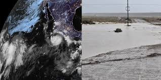
Tropical Storm Polo is strengthening in the Pacific Ocean and is forecast to become a hurricane by Tuesday, a development that could influence weather patterns across the southwestern United States, including California. The National Hurricane Center described the expected storm as «small but very dangerous» as it continues to organize over warm ocean waters.
The system is part of an active stretch in the eastern Pacific, where multiple tropical cyclones have formed in recent weeks. Forecasters are monitoring whether Polo's moisture and energy could be drawn northward, potentially adding rain to parts of California and the Southwest that have already seen unusual late-summer precipitation. The storm's exact track and intensity remain uncertain, and its ultimate impact on the U.S. mainland will depend on how it interacts with broader atmospheric steering currents.
According to the National Hurricane Center, Polo is expected to intensify into a hurricane by Tuesday. The center warned that the storm could become «small but very dangerous,» a phrase that underscores the risk posed by compact, rapidly intensifying systems. Such storms can undergo sudden changes in strength, making them particularly challenging to forecast and prepare for.
While Polo is currently far from the California coast, its projected path has drawn attention because of the potential for increased moisture to reach the region. California has experienced a series of atmospheric river events and tropical moisture intrusions in recent years, some of which have produced significant rainfall and flooding. Even remnants of tropical systems can trigger heavy rain, especially when they merge with other weather features.
The broader Pacific hurricane season has been active, with several named storms forming and intensifying. Forecasters have noted that warm sea surface temperatures and favorable upper-level winds have created conditions conducive to storm development. Polo is the latest in a series of systems that have kept meteorologists busy and raised concerns about the potential for flooding in the Southwest.
Residents in California and the Southwest are advised to monitor updates from the National Hurricane Center and local weather authorities as Polo's track becomes clearer. The storm's future strength and path will determine whether it brings beneficial rain, dangerous flooding, or remains offshore. Emergency management officials often urge preparedness during hurricane season, particularly when a storm's trajectory could affect populated areas.
The National Hurricane Center continues to issue advisories on Polo, providing detailed information on its location, maximum sustained winds, and projected movement. These updates are critical for coastal communities, shipping interests, and anyone with plans in the affected regions. As Polo strengthens, the next few days will be key in understanding its ultimate impact.
For now, the primary concern is the storm's intensification and its potential to influence weather far beyond its immediate vicinity. Whether California sees additional rainfall from Polo remains an open question, but the possibility alone is enough to keep forecasters and residents attentive. The National Hurricane Center's guidance will be essential in the coming days as the system evolves.